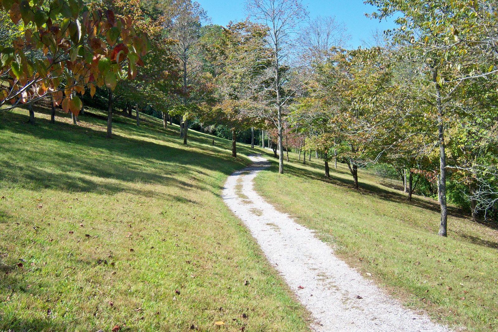
The photo above is a stock photo of the prettiest portion of what is known as the Kiwanis Hiking Trail at Paintsville Lake State Park which is a trail I hike regularly and just hiked today, in fact. The trail actually begins near the Kentucky Mountain Homeplace which is also well worth a visit. You can park in their parking lot, and out of courtesy, as far from their headquarters building as possible and start your hike at either end of the trail which makes a loop around the Army Corps of Engineers headquarters and the Kentucky Mountain Homeplace. The trail has a couple of slight uphills or downhills but is actually rated, in my mind, as easy. The section in the photo is just east of and below the Corps of Engineers headquarters and a few hundred yards from the beginning on the highway near KMH. Paintsville Lake and the marina area are below the trail at this point and just east of it. A small section of the lake is visible from the trail along with part of the marina area. Then the trail goes away from the lake, crosses the emergency spillway (or gives you the option of shortening your hike a little by taking the emergency spillway until you rejoin the loop of the main trail near the SW corner of the KMH property. I actually took that option today although I usually hike the entire loop of the trail with an extra twist or two thrown in. The main loop is more tree shaded, feels a bit more isolated, and has a generally prettier look than the emergency spillway which is actually a cut through in the hillside which leaves a flat grassy area maybe 100 yards wide which functions as the emergency spillway.
When I say that I throw in an extra twist or two to my hikes here, what I mean is that I usually park at the spillway near the public restrooms and public trout stocking area, maybe take one full loop around the spillway area and then hit the face of the dam, go straight up the dam to the highway which crosses there to access the Corps of Engineers office and KMH. I hike straight up several of the flood control lake dams in Eastern Kentucky and I recommend it if you are a strong hiker with a good heart and lungs, strong legs, and a good back. But all these dams are steep, high, and tough. The Paintsville dam is especially tough since it has a large area of boulders about 100 feet from bottom to top all across the dam due most probably to some past seepage problem. Do not attempt this dam unless you are pretty tough and nimble. The second twist I throw in my hikes here is that when I have hiked about 90% of the entire loop and I am back in the area overlooking the spillway where I park, I hit the woods downhill toward the spillway. It is typical Eastern Kentucky woodland, steep, and rocky. It also has a couple of places where you could fall 30 feet or so. But in this area, there is an ancient rock shelter, not a cave, but a rock shelter, overhang, whatever you want to call it which I am sure was used historically by both early native peoples and some of the first settlers in the Paint Creek area as temporary shelter. It would sleep about a half dozen people and IT IS NOT LEGAL TO CAMP IN IT but it is a nice spot to stop for a few minutes at the end of a hike, cool off, and consider how it might have been used historically. Paintsville Lake and the Kiwanis Trail is a nice hike whether you are looking for a relatively easy loop or if you want to make the loop more difficult as I do.
No comments:
Post a Comment